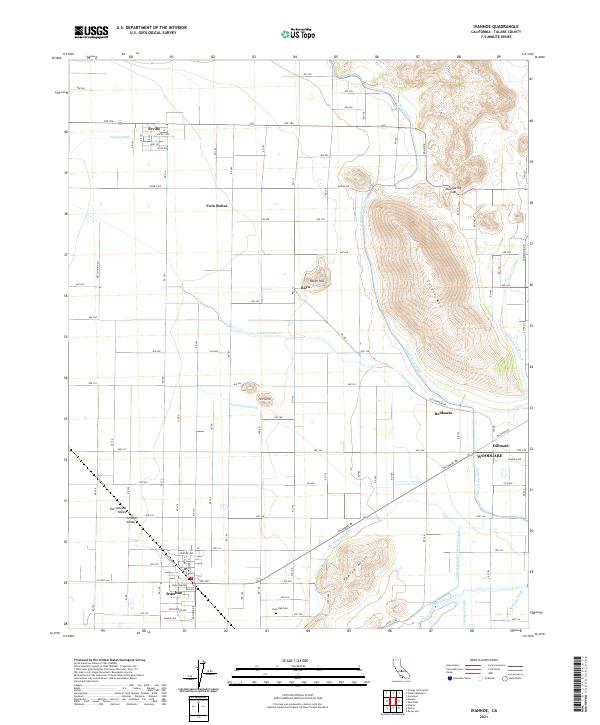
2021 Map of Ivanhoe
USGS Topo · Published 2021About this map
The San Joaquin Valley landscape east of Visalia is defined by an intricate network of irrigation infrastructure and foothill settlements. The town of Ivanhoe serves as a focal point in the southwest, while the northern extent reaches the community of Seville. This territory illustrates the engineered water systems essential to local agriculture, featuring the prominent Friant-Kern Canal as it skirts the base of Colvin Mtn. To the south, the Saint Johns River and Tulare Irrigation District Canal move water across the flats near Venice Hills. Small rural hubs and packing points like Rayo, Redbanks, and Hillmaid are connected by a rigid grid of county roads and avenues. The topography shifts abruptly from the level valley floor to the rising elevations of Bacon Hill and Mud Spring Gap, providing a clear view of the geographic transition between the fertile basin and the Sierra Nevada foothills.
Find a feature on this map
58 named features on this map. Tap any name to fly to it.
Don’t see what you’re looking for? This feature index may not catch every label — zoom into the map to look around manually.
Map Details
Editions of this 2021 Ivanhoe Map
This is the sole edition of this map. No revisions or reprints were ever made.
Other maps of this area

1921 · Stokes Mountain
USGS Topo · 1:24,000

1922 · Trimmer
USGS Topo · 1:96,000

1923 · Sultana
USGS Topo · 1:31,680

1924 · Dinuba
USGS Topo · 1:125,000

1924 · Stokes Mountain
USGS Topo · 1:31,680

1925 · Rocky Hill
USGS Topo · 1:31,680

1926 · Ivanhoe
USGS Topo · 1:31,680

1926 · Exeter
USGS Topo · 1:31,680

1927 · Monson
USGS Topo · 1:31,680

1927 · Rocky Hill
USGS Topo · 1:31,680