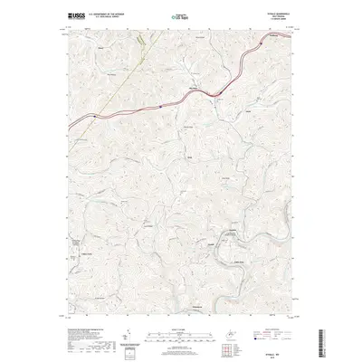
2019 Map of Ivydale
USGS Topo · Published 2019About this map
The Elk River winds through this Central West Virginia landscape at the junction of Clay Co, Roane Co, and Calhoun Co. The settlement of Ivydale serves as a primary local node, featuring the J C Cruikshank Memorial Bridge and providing access to the Elk River Water Trail. The topography is defined by narrow valleys and high ridges such as Laurel Ridge and Valley Ridge, with numerous family-named hollows and cemeteries marking the generational heritage of the area.
Find a feature on this map
118 named features on this map. Tap any name to fly to it.
Don’t see what you’re looking for? This feature index may not catch every label — zoom into the map to look around manually.
Map Details
Editions of this 2019 Ivydale Map
This is the sole edition of this map. No revisions or reprints were ever made.
Other maps of this area

1889 · Nicholas
USGS Topo · 1:125,000

1891 · Nicholas
USGS Topo · 1:125,000

1893 · Sutton
USGS Topo · 1:125,000

1897 · Kanawha Falls
USGS Topo · 1:125,000

1900 · Kanawha Falls
USGS Topo · 1:125,000

1901 · Nicholas
USGS Topo · 1:125,000

1901 · Kanawha Falls
USGS Topo · 1:125,000

1906 · Otter
USGS Topo · 1:62,500

1907 · Otter
USGS Topo · 1:62,500

1908 · Clay
USGS Topo · 1:48,000