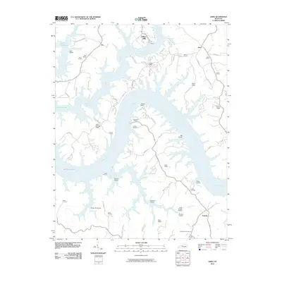
2010 Map of Jabez
USGS Topo · Published 2010About this map
Lake Cumberland dominates this 2010 topographical landscape, with its dendritic fingers reaching deep into the ridges of Wayne and Russell Counties. The Cumberland River valley is characterized by high, narrow ridges such as Ono Ridge, Denny Ridge, and Cave Springs Ridge, where small communities and family cemeteries have persisted for generations. Settlements like Jabez, Ono, and Eadsville are connected by winding country roads that follow the high ground, while the water's edge is marked by recreation and conservation sites including Camp Earl Wallace and Indian Hills.
Find a feature on this map
79 named features on this map. Tap any name to fly to it.
Don’t see what you’re looking for? This feature index may not catch every label — zoom into the map to look around manually.
Map Details
Editions of this 2010 Jabez Map
This is the sole edition of this map. No revisions or reprints were ever made.
Other maps of this area

1911 · Monticello
USGS Topo · 1:62,500

1914 · Monticello
USGS Topo · 1:62,500

1953 · Parnell
USGS Topo · 1:24,000

1953 · Monticello
USGS Topo · 1:24,000

1953 · Mill Springs
USGS Topo · 1:24,000

1953 · Jamestown
USGS Topo · 1:24,000

1954 · Jabez
USGS Topo · 1:24,000

1954 · Cumberland City
USGS Topo · 1:24,000

1954 · Russell Springs
USGS Topo · 1:24,000

1954 · Eli
USGS Topo · 1:24,000