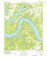
1978 Map of Jabez
USGS Topo · Published 1978About this map
Lake Cumberland dominates this 1970s landscape, its intricate shoreline winding through the rugged border of Russell and Wayne counties. The map records the area after the controlled inundation of the river valley, showing the transition of the Cumberland River into a massive reservoir system. Along the high ground of Ono Ridge and Parks Ridge, small agricultural settlements like Ono and Jabez persist, while the waterfront is redefined by recreational landmarks such as Camp Earl Wallace and the Wolf Creek Recreation Area.
Find a feature on this map
67 named features on this map. Tap any name to fly to it.
Don’t see what you’re looking for? This feature index may not catch every label — zoom into the map to look around manually.
Map Details
Editions of this 1978 Jabez Map
This is the sole edition of this map. No revisions or reprints were ever made.
Other maps of this area

1911 · Monticello
USGS Topo · 1:62,500

1914 · Monticello
USGS Topo · 1:62,500

1953 · Parnell
USGS Topo · 1:24,000

1953 · Monticello
USGS Topo · 1:24,000

1953 · Mill Springs
USGS Topo · 1:24,000

1953 · Jamestown
USGS Topo · 1:24,000

1954 · Jabez
USGS Topo · 1:24,000

1954 · Cumberland City
USGS Topo · 1:24,000

1954 · Russell Springs
USGS Topo · 1:24,000

1954 · Eli
USGS Topo · 1:24,000