
1917 Map of Jacinto
USGS Topo · Published 1917About this map
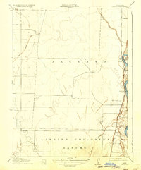
The Sacramento River forms the eastern pulse of this landscape, its winding course defining the agricultural and settlement patterns of northern California. The 1904 field survey captures a critical era in Glenn County water management, dominated by the sweeping arc of the Central Irrigation Canal as it traverses the plains west of the river. This infrastructure was essential for the conversion of former ranching lands into intensive agriculture. Large historic land divisions like the Larkins Children's Rancho still appear as prominent boundaries, reflecting the area's Mexican land grant heritage. Along the riverbanks, small riverside communities and landing points such as Jacinto, Glenn, and Sidds Landing served as vital collection points for the region's produce, situated near river features like the Llano Seco bend and Shepard Slough.
Find a feature on this map
9 named features on this map. Tap any name to fly to it.
Don’t see what you’re looking for? This feature index may not catch every label — zoom into the map to look around manually.
Map Details
Editions of this 1917 Jacinto Map
2 editions found
Other maps of this area

1888 · Marysville
USGS Topo · 1:125,000

1891 · Chico
USGS Topo · 1:125,000

1891 · Marysville
USGS Topo · 1:125,000

1893 · Chico
USGS Topo · 1:125,000

1894 · Marysville
USGS Topo · 1:125,000

1895 · Marysville
USGS Topo · 1:125,000

1895 · Chico
USGS Topo · 1:125,000

1906 · Maxwell
USGS Topo · 1:62,500

1906 · Willows
USGS Topo · 1:62,500

1912 · Butte City
USGS Topo · 1:31,680