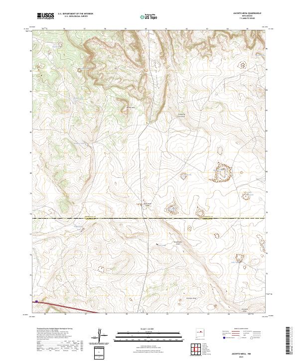
2023 Map of Jacinto Mesa
USGS Topo · Published 2023About this map
Jacinto Mesa anchors this landscape in eastern New Mexico, where the high plateau is carved by numerous drainage systems. The terrain is defined by dramatic elevation changes along Cañon de Jacinto and Cañon de la Luvina, reflecting the traditional land use of the high desert. A complex network of water catchments, including Molasses Tank, Buddy Tank, and Charlies Tank, supports the arid environment, while the map reveals the precise boundary line where San Miguel and Torrance counties meet. This modern survey captures a landscape of intermittent watercourses like Agua Verde Draw and Empedrados Draw, illustrating the vital importance of seasonal water management in a region defined by its mesas and deep arroyos.
Find a feature on this map
24 named features on this map. Tap any name to fly to it.
Don’t see what you’re looking for? This feature index may not catch every label — zoom into the map to look around manually.
Map Details
Editions of this 2023 Jacinto Mesa Map
This is the sole edition of this map. No revisions or reprints were ever made.
Other maps of this area

1890 · Bernal
USGS Topo · 1:125,000

1891 · Bernal
USGS Topo · 1:125,000

1894 · Bernal
USGS Topo · 1:125,000

1894 · Lamy
USGS Topo · 1:125,000

1954 · Santa Fe
USGS Topo · 1:250,000

1954 · Fort Sumner
USGS Topo · 1:250,000

1958 · Fort Sumner
USGS Topo · 1:250,000

1958 · Santa Fe
USGS Topo · 1:250,000

1963 · Jacinto Mesa
USGS Topo · 1:24,000

1963 · Aurora
USGS Topo · 1:24,000