
1963 Map of Jacinto Mesa
USGS Topo · Published 1965About this map
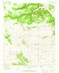
Jacinto Mesa and its surrounding high desert landscape dominate this 1963 survey of the New Mexico interior, where the border of San Miguel and Torrance counties meets. The territory is characterized by a sophisticated network of water management features essential for ranching in this arid environment, including Jacinto Tank, Refugio Tank, and Nicholas Tank. The settlement pattern is defined by isolated outposts such as Agua Verde Ranch, Trujillo Ranch, and Maes Ranch, which are situated near the seasonal drainage of Agua Verde Draw and Encinosa Draw. Significant landforms like Cañon del Jacinto and Laguna del Sauzno provide distinct geographical markers across the plains, while the presence of a Pipeline and several industrial features like Franks Pit and Victors Pit suggest the mid-century infrastructure supporting the local economy.
Find a feature on this map
30 named features on this map. Tap any name to fly to it.
Don’t see what you’re looking for? This feature index may not catch every label — zoom into the map to look around manually.
Map Details
Editions of this 1963 Jacinto Mesa Map
This is the sole edition of this map. No revisions or reprints were ever made.
Other maps of this area

1890 · Bernal
USGS Topo · 1:125,000

1891 · Bernal
USGS Topo · 1:125,000

1894 · Bernal
USGS Topo · 1:125,000

1894 · Lamy
USGS Topo · 1:125,000

1954 · Santa Fe
USGS Topo · 1:250,000

1954 · Fort Sumner
USGS Topo · 1:250,000

1958 · Fort Sumner
USGS Topo · 1:250,000

1958 · Santa Fe
USGS Topo · 1:250,000

1963 · Aurora
USGS Topo · 1:24,000
1963 · Potrillo Hill
USGS Topo · 1:24,000