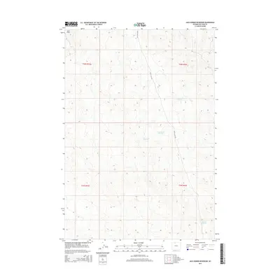
2015 Map of Jack Horner Reservoir
USGS Topo · Published 2015About this map
Jack Horner Reservoir and several neighboring basins define this arid Big Horn County landscape as it appeared in 2015. The terrain is structured by a network of drainage systems, most notably Sand Draw in the northwest corner, which cuts through the topography of the Big Horn Basin. Small-scale water management is the primary human imprint on the land here, evidenced by the scattered locations of North Snyder Reservoir, Snyder Reservoir, and Tommy Tucker Reservoir. These features suggest a reliance on collected runoff for local use in a region characterized by sparse vegetation and significant elevation changes. The only major named transit corridor is Foster Gulch Rd, which snakes north-to-south across the high desert, providing the main artery through the township divisions of t55n r97w and t55n r96w.
Find a feature on this map
10 named features on this map. Tap any name to fly to it.
Don’t see what you’re looking for? This feature index may not catch every label — zoom into the map to look around manually.
Map Details
Editions of this 2015 Jack Horner Reservoir Map
This is the sole edition of this map. No revisions or reprints were ever made.
Other maps of this area

1955 · Cody
USGS Topo · 1:250,000

1958 · Cody
USGS Topo · 1:250,000

1962 · Cody
USGS Topo · 1:250,000

1964 · Lovell Lakes
USGS Topo · 1:24,000

1966 · Gilmore Hill NE
USGS Topo · 1:24,000

1966 · North Emblem Reservoir
USGS Topo · 1:24,000

1966 · Gilmore Hill SE
USGS Topo · 1:24,000

1966 · Jack Horner Reservoir
USGS Topo · 1:24,000

1966 · Emblem SE
USGS Topo · 1:24,000
1966 · Lovell
USGS Topo · 1:24,000