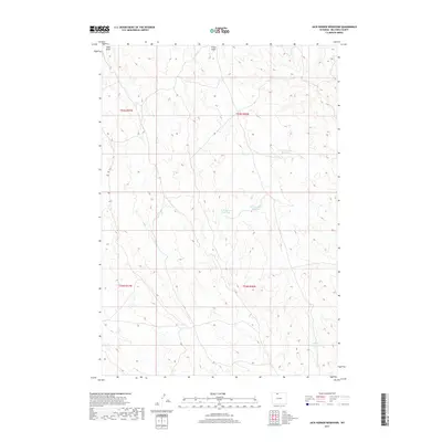
2017 Map of Jack Horner Reservoir
USGS Topo · Published 2017About this map
Jack Horner Reservoir and the surrounding high-plains landscape of Big Horn County are captured here in a 2017 survey. The terrain is defined by its water management features and drainage patterns, including Sand Draw and Foster Gulch. This arid region relies on a network of small impoundments such as North Snyder Reservoir, Tommy Tucker Reservoir, and Snyder Reservoir to manage seasonal runoff. The map clearly delineates the township and range boundaries of t55n r97w and t55n r96w, illustrating the geometric land divisions characteristic of the American West. The lack of major settlements highlights the rural, open character of this part of Wyoming, where geography is shaped more by the flow of water and public land management than by urban development.
Find a feature on this map
10 named features on this map. Tap any name to fly to it.
Don’t see what you’re looking for? This feature index may not catch every label — zoom into the map to look around manually.
Map Details
Editions of this 2017 Jack Horner Reservoir Map
This is the sole edition of this map. No revisions or reprints were ever made.
Other maps of this area

1955 · Cody
USGS Topo · 1:250,000

1958 · Cody
USGS Topo · 1:250,000

1962 · Cody
USGS Topo · 1:250,000

1964 · Lovell Lakes
USGS Topo · 1:24,000

1966 · Gilmore Hill NE
USGS Topo · 1:24,000

1966 · North Emblem Reservoir
USGS Topo · 1:24,000

1966 · Gilmore Hill SE
USGS Topo · 1:24,000

1966 · Jack Horner Reservoir
USGS Topo · 1:24,000

1966 · Emblem SE
USGS Topo · 1:24,000
1966 · Lovell
USGS Topo · 1:24,000