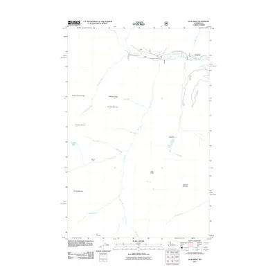
2011 Map of Jack Ridge
USGS Topo · Published 2011About this map
Icicle Creek carves a deep valley across this terrain, serving as a primary corridor for early 21st-century access via the Natl Forest Develop Road 7600 Rd. This mountain landscape is defined by its drainage basins and high summits, including Highchair Mountain and Eightmile Mountain. The presence of the Van Epps Mine at the southern edge suggests the area's history of mineral exploration, while the concentration of established sites like Black Pine Campground and Chatter Creek Campground reflects its role as a destination for backcountry recreation.
Find a feature on this map
28 named features on this map. Tap any name to fly to it.
Don’t see what you’re looking for? This feature index may not catch every label — zoom into the map to look around manually.
Map Details
Editions of this 2011 Jack Ridge Map
This is the sole edition of this map. No revisions or reprints were ever made.
Other maps of this area

1897 · Mount Stuart
USGS Topo · 1:125,000

1901 · Chiwaukum
USGS Topo · 1:125,000

1901 · Snoqualmie Pass
USGS Topo · 1:125,000

1902 · Skykomish
USGS Topo · 1:125,000

1902 · Mount Stuart
USGS Topo · 1:125,000

1903 · Snoqualmie
USGS Topo · 1:125,000

1904 · Chiwaukum
USGS Topo · 1:125,000

1905 · Skykomish
USGS Topo · 1:125,000

1957 · Wenatchee
USGS Topo · 1:250,000

1961 · Mount Stuart
USGS Topo · 1:62,500