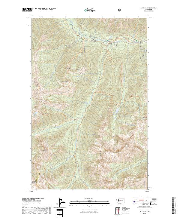
2023 Map of Jack Ridge
USGS Topo · Published 2023About this map
Icicle Creek carves through the heart of the Wenatchee National Forest in this high-elevation mountain study. The landscape is defined by its dramatic relief, anchored by prominent peaks like Bootjack Mtn, Highchair Mtn, and Eightmile Mtn. The transition from the Alpine Lakes Wilderness into the surrounding forest reveals a sophisticated network of wilderness trails, including the Jack Ridge Trl and Blackjack Ridge Trl, which navigate the steep divides between drainage basins. This area is a critical hydrological hub, where numerous alpine sources like Cradle Lake and Trout Lake feed into tributary systems such as Jack Creek and Trout Creek. The presence of Windy Pass and Sixtysix Hundred Ridge highlights the formidable natural barriers that have shaped movement through the Wenatchee Mountains.
Find a feature on this map
45 named features on this map. Tap any name to fly to it.
Don’t see what you’re looking for? This feature index may not catch every label — zoom into the map to look around manually.
Map Details
Editions of this 2023 Jack Ridge Map
This is the sole edition of this map. No revisions or reprints were ever made.
Other maps of this area

1897 · Mount Stuart
USGS Topo · 1:125,000

1901 · Chiwaukum
USGS Topo · 1:125,000

1901 · Snoqualmie Pass
USGS Topo · 1:125,000

1902 · Skykomish
USGS Topo · 1:125,000

1902 · Mount Stuart
USGS Topo · 1:125,000

1903 · Snoqualmie
USGS Topo · 1:125,000

1904 · Chiwaukum
USGS Topo · 1:125,000

1905 · Skykomish
USGS Topo · 1:125,000

1957 · Wenatchee
USGS Topo · 1:250,000

1961 · Mount Stuart
USGS Topo · 1:62,500