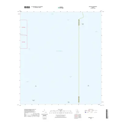
2018 Map of Jacko Bay
USGS Topo · Published 2018About this map
Gulf of Mexico waters dominate this coastal section of southern Louisiana, where the boundary between Terrebonne Parish and Lafourche Parish runs through the open marshes and bays. The landscape is a fragmented collection of islands and shallow water bodies, reflecting the dynamic nature of the Mississippi River delta plain. To the west, Jacko Bay and Terrebonne Bay are protected by Cat Island and Terrebonne Island, while to the east, the waters of Timbalier Bay and Lake Raccourci are punctuated by the Bull Islands and Fornation Islands. Notable interior water features like Old Lady Lake and Bayou de la Valle demonstrate the intricate network of inland waterways that define this precarious interface between land and sea. This 2018 survey provides a precise record of these barrier islands and estuaries, including the Pelican Islands, which are critical to the region's environmental and geographic profile.
Find a feature on this map
14 named features on this map. Tap any name to fly to it.
Don’t see what you’re looking for? This feature index may not catch every label — zoom into the map to look around manually.
Map Details
Editions of this 2018 Jacko Bay Map
This is the sole edition of this map. No revisions or reprints were ever made.
Other maps of this area

1894 · Timbalier
USGS Topo · 1:62,500

1894 · Lake Felicity
USGS Topo · 1:62,500

1894 · Dulac
USGS Topo · 1:62,500

1935 · Bourbeux
USGS Topo · 1:31,680

1935 · Timbalier Island
USGS Topo · 1:31,680

1935 · Bay Courant
USGS Topo · 1:31,680

1935 · Pelican Pass
USGS Topo · 1:31,680

1935 · Calumet Island
USGS Topo · 1:31,680

1939 · Lake Felicity
USGS Topo · 1:62,500

1941 · Lake Felicity
USGS Topo · 1:62,500