
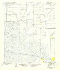
1953 Map of Jacks Point Island
USGS Topo · Published 1980About this map
White Lake dominates the southern landscape of this 1970s orthophotomap, where the interface between open water and the Louisiana marsh is captured with photographic precision. The terrain is defined by low-lying elevations like Pine Island, Rabbit Island, and Jacks Point Island, which provide rare stable ground amidst the surrounding wetlands. This environment is dissected by a network of man-made and natural water routes, including the Intracoastal Waterway and the Warren Canal.
Find a feature on this map
12 named features on this map. Tap any name to fly to it.
Don’t see what you’re looking for? This feature index may not catch every label — zoom into the map to look around manually.
Map Details
Editions of this 1953 Jacks Point Island Map
This is the sole edition of this map. No revisions or reprints were ever made.
Other maps of this area

1932 · Constance Bayou NE
USGS Topo · 1:31,680

1945 · Pecan Island NW
USGS Topo · 1:31,680

1945 · Pecan Island NE
USGS Topo · 1:31,680

1946 · Schooner Bayou SE
USGS Topo · 1:31,680

1946 · Schooner Bayou NE
USGS Topo · 1:31,680

1946 · Schooner Bayou NW
USGS Topo · 1:31,680

1946 · Schooner Bayou SW
USGS Topo · 1:31,680

1951 · Pecan Island
USGS Topo · 1:62,500

1954 · Grand Lake East SE
USGS Topo · 1:31,680
1954 · Schooner Bayou NW
USGS Topo · 1:31,680