
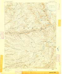
1889 Map of Jackson
USGS Topo · Published 1889About this map
The Mokelumne River and its numerous forks define the hydraulic landscape of the Mother Lode region during the height of its post-Gold Rush development. This 1888 survey documents the vital water infrastructure necessary for mining and agriculture, including an extensive Aqueduct and several reservoirs near Sutter Creek. The map details the transition from river-based transport to iron rails, featuring the Amador Branch Railroad and the San Joaquin and Sierra Nevada Railroad as they penetrate the foothills toward Jackson and San Andreas.
Find a feature on this map
127 named features on this map. Tap any name to fly to it.
Don’t see what you’re looking for? This feature index may not catch every label — zoom into the map to look around manually.
Map Details
Editions of this 1889 Jackson Map
This is the sole edition of this map. No revisions or reprints were ever made.
Other maps of this area

1889 · Pyramid Peak
USGS Topo · 1:125,000

1891 · Sacramento
USGS Topo · 1:125,000

1891 · Big Trees
USGS Topo · 1:125,000

1891 · Placerville
USGS Topo · 1:125,000
1891 · Pyramid Peak
USGS Topo · 1:125,000

1892 · Jackson
USGS Topo · 1:125,000

1892 · Sacramento
USGS Topo · 1:125,000

1892 · Placerville
USGS Topo · 1:125,000

1893 · Placerville
USGS Topo · 1:125,000

1893 · Sonora
USGS Topo · 1:125,000