
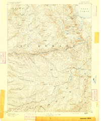
1892 Map of Jackson
USGS Topo · Published 1892About this map
Mokelumne River and Calaveras River divide this Mother Lode landscape into distinct mining and agricultural zones during the late nineteenth century. The terrain is a network of ridges and gulches, featuring the prominent Bear Mountains and Gopher Ridge. Settlement patterns follow the gold-bearing geology, with established centers like San Andreas, Mokelumne Hill, and the hydraulic mining remains near Rich Gulch Mine.
Find a feature on this map
127 named features on this map. Tap any name to fly to it.
Don’t see what you’re looking for? This feature index may not catch every label — zoom into the map to look around manually.
Map Details
Editions of this 1892 Jackson Map
This is the sole edition of this map. No revisions or reprints were ever made.
Other maps of this area

1889 · Jackson
USGS Topo · 1:125,000

1889 · Pyramid Peak
USGS Topo · 1:125,000

1891 · Sacramento
USGS Topo · 1:125,000

1891 · Big Trees
USGS Topo · 1:125,000

1891 · Placerville
USGS Topo · 1:125,000
1891 · Pyramid Peak
USGS Topo · 1:125,000

1892 · Sacramento
USGS Topo · 1:125,000

1892 · Placerville
USGS Topo · 1:125,000

1893 · Placerville
USGS Topo · 1:125,000

1893 · Sonora
USGS Topo · 1:125,000