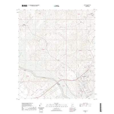
2020 Map of Jackson
USGS Topo · Published 2020About this map
The Tombigbee River defines the western edge of Jackson, Alabama, where the modern Joe C McCorquodale Junior Bridge spans the water into neighboring Washington County. This survey reveals the town's detailed street grid, including College Ave and Kimbell Ave, while highlighting the transition from the concentrated settlement of the river port to the surrounding rural crossroads. To the north and west, smaller communities like Mays Crossroads, McVay, and Toddtown are connected by a network of local roads such as Salt Works Rd and Bolen Town Rd. The landscape is dotted with several family and community burial sites, including Pine Crest Cem, Forman Cem, and the Stave Creek Cem, providing essential markers for genealogical research in this portion of Clarke County.
Find a feature on this map
103 named features on this map. Tap any name to fly to it.
Don’t see what you’re looking for? This feature index may not catch every label — zoom into the map to look around manually.
Map Details
Editions of this 2020 Jackson Map
This is the sole edition of this map. No revisions or reprints were ever made.
Other maps of this area

1943 · Choctaw Bluff
USGS Topo · 1:62,500

1943 · McIntosh
USGS Topo · 1:62,500

1944 · McIntosh
USGS Topo · 1:62,500

1946 · Choctaw Bluff
USGS Topo · 1:62,500

1953 · Andalusia
USGS Topo · 1:250,000

1953 · Hattiesburg
USGS Topo · 1:250,000

1957 · Andalusia
USGS Topo · 1:250,000

1958 · Hattiesburg
USGS Topo · 1:250,000

1972 · Tattlersville
USGS Topo · 1:24,000

1972 · St. Stephens
USGS Topo · 1:24,000