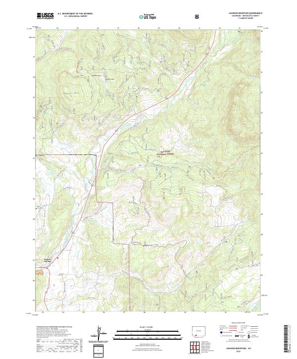
2022 Map of Jackson Mountain
USGS Topo · Published 2022About this map
Pagosa Springs and the surrounding high-country landscape of San Juan National Forest define this terrain in southwestern Colorado. The map reveals a complex water management system essential to the region, featuring gravity-fed works like the Park Ditch, Mesa Ditch, and the Snowball Extension Ditch winding through the foothills. These irrigation lines represent the vital infrastructure supporting local ranching and settlement in a landscape dominated by the rising peaks of Jackson Mtn.
Find a feature on this map
51 named features on this map. Tap any name to fly to it.
Don’t see what you’re looking for? This feature index may not catch every label — zoom into the map to look around manually.
Map Details
Editions of this 2022 Jackson Mountain Map
This is the sole edition of this map. No revisions or reprints were ever made.
Other maps of this area

1913 · Summitville
USGS Topo · 1:125,000

1915 · Summitville
USGS Topo · 1:125,000

1924 · Pagosa Springs
USGS Topo · 1:125,000

1927 · Pagosa Springs
USGS Topo · 1:125,000

1945 · Durango
USGS Topo · 1:250,000

1953 · Durango
USGS Topo · 1:250,000

1954 · Durango
USGS Topo · 1:250,000

1957 · Chromo
USGS Topo · 1:62,500

1957 · Wolf Creek Pass
USGS Topo · 1:62,500

1957 · Pagosa Junction
USGS Topo · 1:62,500