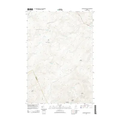
2014 Map of Jackson Mountain
USGS Topo · Published 2014About this map
The Appalachian National Scenic Trail traverses the northern highlands of this Maine landscape, cutting across a ridge system that includes Horn Hill and the Blue Mountains. This 2014 survey reveals a region defined by high-elevation water bodies and steep relief, centered on the massif containing Jackson Mountain, Little Jackson Mountain, and Tumbledown Mountain. The drainage patterns here are complex, with the Sandy River and Smalls Falls in the northeast contrasting with the numerous headwater streams like Jont Stream and the E Br Swift River that flow southward. Small, isolated lakes such as Southwest Pond, Harvey Pond, and Jackson Pond sit tucked between the peaks, while larger wetland features like Witham Bog occupy the high basins. The map captures the interface of Franklin Co and Oxford Co, where limited road access like Rangeley Rd and Crosstown Rd skirts the edges of the heavy terrain.
Find a feature on this map
32 named features on this map. Tap any name to fly to it.
Don’t see what you’re looking for? This feature index may not catch every label — zoom into the map to look around manually.
Map Details
Editions of this 2014 Jackson Mountain Map
This is the sole edition of this map. No revisions or reprints were ever made.
Other maps of this area

1926 · Dixfield
USGS Topo · 1:62,500

1927 · Rumford
USGS Topo · 1:48,000

1929 · Phillips
USGS Topo · 1:48,000

1929 · Dixfield
USGS Topo · 1:62,500

1930 · Rumford
USGS Topo · 1:62,500

1932 · Phillips
USGS Topo · 1:62,500

1933 · Rangeley
USGS Topo · 1:48,000

1939 · Rangeley
USGS Topo · 1:62,500

1949 · Rangeley
USGS Topo · 1:62,500

1950 · Lewiston
USGS Topo · 1:250,000
Featured Places
- Rangeley Plantation, ME
- Madrid Township, ME
- Sandy River Plantation, ME
- Byron, ME
- Township 6 North of Weld, ME