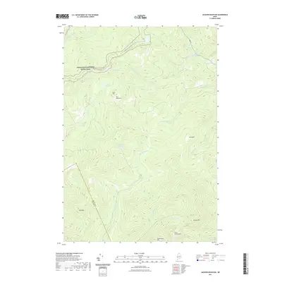
2021 Map of Jackson Mountain
USGS Topo · Published 2021About this map
Appalachian National Scenic Trail traverses the northern reaches of this mountainous landscape, winding past Witham Pond and Witham Bog near the Blue Mountains. The terrain is characterized by dramatic elevation changes, defined by significant peaks such as Jackson Mtn, Tumbledown Mtn, and Dolly Mtn. These summits serve as headwaters for a dense network of water systems, including the Sandy River and the various branches of the Swift River, such as the E Br Swift River and W Br Swift River.
Find a feature on this map
32 named features on this map. Tap any name to fly to it.
Don’t see what you’re looking for? This feature index may not catch every label — zoom into the map to look around manually.
Map Details
Editions of this 2021 Jackson Mountain Map
This is the sole edition of this map. No revisions or reprints were ever made.
Other maps of this area

1926 · Dixfield
USGS Topo · 1:62,500

1927 · Rumford
USGS Topo · 1:48,000

1929 · Phillips
USGS Topo · 1:48,000

1929 · Dixfield
USGS Topo · 1:62,500

1930 · Rumford
USGS Topo · 1:62,500

1932 · Phillips
USGS Topo · 1:62,500

1933 · Rangeley
USGS Topo · 1:48,000

1939 · Rangeley
USGS Topo · 1:62,500

1949 · Rangeley
USGS Topo · 1:62,500

1950 · Lewiston
USGS Topo · 1:250,000
Featured Places
- Rangeley Plantation, ME
- Madrid Township, ME
- Sandy River Plantation, ME
- Byron, ME
- Township 6 North of Weld, ME