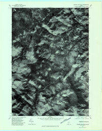
1977 Map of Jackson Mountain
USGS Topo · Published 1983About this map
Jackson Mountain and the high ridge of Tumbledown Mountain dominate this part of Franklin County, where the topography transitions into the steep drainage basins of the western Maine mountains. The orthophoto format reveals the dense, uninterrupted forest cover of the late 1970s, intersected by a network of waterways including the Sandy River and the Swift River. To the west, the East Branch flows through deep valleys, while smaller features like Chandler and Mill Stream underscore the hydrological character of the landscape. This imagery is particularly valuable for identifying logging roads and natural clearings around Horn Hill that are not always discernible on standard line maps, providing a precise look at the wilderness state of the region before modern development or large-scale changes in forest management.
Find a feature on this map
8 named features on this map. Tap any name to fly to it.
Don’t see what you’re looking for? This feature index may not catch every label — zoom into the map to look around manually.
Map Details
Editions of this 1977 Jackson Mountain Map
This is the sole edition of this map. No revisions or reprints were ever made.
Other maps of this area

1926 · Dixfield
USGS Topo · 1:62,500

1927 · Rumford
USGS Topo · 1:48,000

1929 · Phillips
USGS Topo · 1:48,000

1929 · Dixfield
USGS Topo · 1:62,500

1930 · Rumford
USGS Topo · 1:62,500

1932 · Phillips
USGS Topo · 1:62,500

1933 · Rangeley
USGS Topo · 1:48,000

1939 · Rangeley
USGS Topo · 1:62,500

1949 · Rangeley
USGS Topo · 1:62,500

1950 · Lewiston
USGS Topo · 1:250,000
Featured Places
- Rangeley Plantation, ME
- Madrid Township, ME
- Sandy River Plantation, ME
- Byron, ME
- Township 6 North of Weld, ME