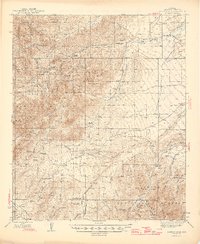
1944 Map of Jackson Mtn.
USGS Topo · Published 1946About this map
The Sierra Bonita Ranch and several other remote outposts anchor this mid-1940s landscape, illustrating the enduring cattle-ranching heritage of the high desert. Situated within the Coronado National Forest, the terrain is defined by the sharp elevations of Jackson Mtn and the Grock Mountains. Water sources are vital landmarks here, from Goodwin Wash in the north to the southern course of Aravaipa Creek, where Cedar Springs and several windmills provided critical support for livestock. Traceable routes like the South Park Trail and Prospect Trail hint at the movement of people and animals through steep canyons such as Cottonwood Canyon and Underwood Canyon. Small-scale mining activity is evidenced by scattered prospects, particularly near Juan Hill, highlighting the diverse yet sparse industrial footprint in the area during this era.
Find a feature on this map
56 named features on this map. Tap any name to fly to it.
Don’t see what you’re looking for? This feature index may not catch every label — zoom into the map to look around manually.
Map Details
Editions of this 1944 Jackson Mtn. Map
3 editions found
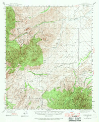
Other maps of this area

1938 · Galiuro Mts
USGS Topo · 1:48,000

1938 · Klondyke
USGS Topo · 1:48,000

1940 · Sierra Bonita Ranch
USGS Topo · 1:62,500

1942 · Sierra Bonita Ranch
USGS Topo · 1:62,500

1942 · Mt. Graham
USGS Topo · 1:62,500

1943 · Galiuro Mts
USGS Topo · 1:62,500

1943 · Klondyke
USGS Topo · 1:62,500

1943 · Sierra Bonita Ranch
USGS Topo · 1:62,500

1944 · Jackson Mtn.
USGS Topo · 1:62,500

1945 · Mt. Graham
USGS Topo · 1:62,500