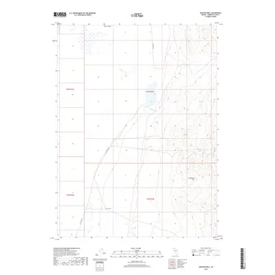
2018 Map of Jackson Well
USGS Topo · Published 2018About this map
Desert Valley dominates this arid landscape in northwestern Nevada, showing the stark transition between the valley floor and the rising elevations of the Slumbering Hills. The map centers on the crucial water source of Jackson Well, a named landmark in an area defined more by its terrain and natural features than by dense settlement. Human presence is sparse, marked primarily by the linear path of Sod House Rd, which provides one of the few navigational corridors through the region. This 2018 survey reveals the methodical grid of the Public Land Survey System, with township and range lines such as t40n r35e overlaying the basin, illustrating how modern administrative boundaries are imposed upon the ancient, unchanged topography of the Great Basin.
Find a feature on this map
8 named features on this map. Tap any name to fly to it.
Don’t see what you’re looking for? This feature index may not catch every label — zoom into the map to look around manually.
Map Details
Editions of this 2018 Jackson Well Map
This is the sole edition of this map. No revisions or reprints were ever made.
Other maps of this area

1882 · Paradise
USGS Topo · 1:250,000

1886 · Disaster
USGS Topo · 1:250,000

1893 · Paradise
USGS Topo · 1:250,000

1893 · Disaster
USGS Topo · 1:250,000

1954 · Vya
USGS Topo · 1:250,000

1955 · McDermitt
USGS Topo · 1:250,000

1958 · Vya
USGS Topo · 1:250,000

1958 · Awakening Peak
USGS Topo · 1:62,500

1959 · McDermitt
USGS Topo · 1:250,000

1962 · Vya
USGS Topo · 1:250,000