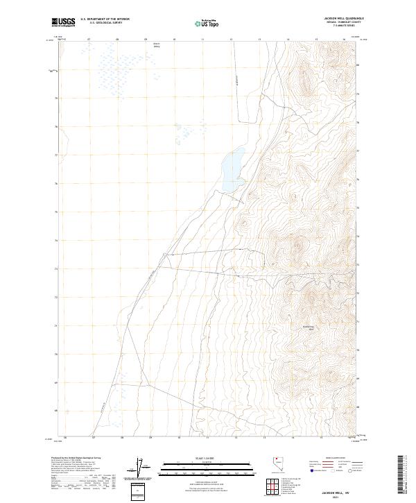
2021 Map of Jackson Well
USGS Topo · Published 2021About this map
Slumbering Hills rise in the eastern portion of this map, providing a stark topographical contrast to the flat expanse of Desert Valley to the west. This high-desert landscape in Humboldt County is defined by its isolation and the presence of ephemeral water features characteristic of the Great Basin. The primitive path of Sod House Rd cuts through the western basin, following the natural contours of the valley floor between the township boundaries of t40n r34e and t39n r35e. This modern survey documents a section of Nevada where the lack of permanent settlements emphasizes the vast, undeveloped nature of the state's interior basins, leaving the terrain and drainage patterns as the primary features for navigation.
Find a feature on this map
7 named features on this map. Tap any name to fly to it.
Don’t see what you’re looking for? This feature index may not catch every label — zoom into the map to look around manually.
Map Details
Editions of this 2021 Jackson Well Map
This is the sole edition of this map. No revisions or reprints were ever made.
Other maps of this area

1882 · Paradise
USGS Topo · 1:250,000

1886 · Disaster
USGS Topo · 1:250,000

1893 · Paradise
USGS Topo · 1:250,000

1893 · Disaster
USGS Topo · 1:250,000

1954 · Vya
USGS Topo · 1:250,000

1955 · McDermitt
USGS Topo · 1:250,000

1958 · Vya
USGS Topo · 1:250,000

1958 · Awakening Peak
USGS Topo · 1:62,500

1959 · McDermitt
USGS Topo · 1:250,000

1962 · Vya
USGS Topo · 1:250,000