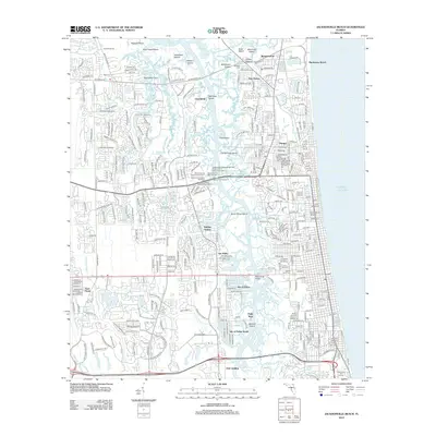
2012 Map of Jacksonville Beach
USGS Topo · Published 2012About this map
The maritime landscape of Manhattan Beach and its surrounding coastal islands are defined by the winding waters of Pablo Cr and Chicopit Bay. This survey captures the intensive maritime infrastructure along the water, including industrial landmarks like the Jacksonville Shipyards Bellinger Division Pier 1 Obstruction Light and several Mobro Marine facilities. The interior is characterized by a high density of residential developments and communities such as Donner, Sans Pareil, and the Isle of Palms.
Find a feature on this map
53 named features on this map. Tap any name to fly to it.
Don’t see what you’re looking for? This feature index may not catch every label — zoom into the map to look around manually.
Map Details
Editions of this 2012 Jacksonville Beach Map
This is the sole edition of this map. No revisions or reprints were ever made.
Other maps of this area

1917 · Orange Park
USGS Topo · 1:62,500

1918 · Jacksonville
USGS Topo · 1:62,500

1918 · Orange Park
USGS Topo · 1:62,500

1918 · Palm Valley
USGS Topo · 1:62,500

1918 · Mayport
USGS Topo · 1:62,500

1948 · Jacksonville
USGS Topo · 1:250,000

1948 · Jacksonville Beach
USGS Topo · 1:24,000

1948 · Eastport
USGS Topo · 1:24,000

1949 · Jacksonville Beach
USGS Topo · 1:24,000

1950 · Arlington
USGS Topo · 1:24,000
Featured Places
- Jacksonville, FL
- Jacksonville Beach, FL
- Atlantic Beach, FL
- Neptune Beach, FL
- Holiday Harbor, Jacksonville