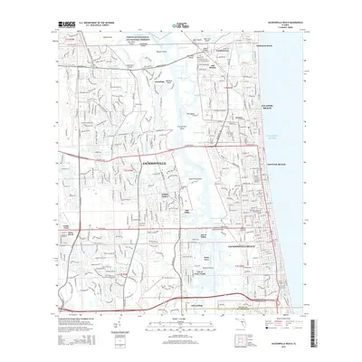
2015 Map of Jacksonville Beach
USGS Topo · Published 2015About this map
Timucuan Ecological and Historic Preserve anchors the northern reaches of this coastal map, protecting a network of salt marshes and tidal creeks such as Chicopit Bay and Greenfield Creek. The landscape transition from the natural wetlands of Dawson Island and Crying Child Island to the densely developed residential grids of Atlantic Beach and Jacksonville Beach illustrates the 21st-century urban character of the Florida coast. Between the mainland and the barrier island communities, the Intracoastal Waterway serves as a critical maritime artery, crossed by the McCormick Bridge along Beach Blvd. In the northeast, the presence of the Indian Mound and the Mayport Cem near Wonderwood points to layers of cultural history that predate the modern subdivisions of Holiday Harbor and Sans Pareil. Educational landmarks like the Stenotype Institute of Jacksonville Inc further mark the contemporary suburban growth of the Jacksonville area.
Find a feature on this map
76 named features on this map. Tap any name to fly to it.
Don’t see what you’re looking for? This feature index may not catch every label — zoom into the map to look around manually.
Map Details
Editions of this 2015 Jacksonville Beach Map
This is the sole edition of this map. No revisions or reprints were ever made.
Other maps of this area

1917 · Orange Park
USGS Topo · 1:62,500

1918 · Jacksonville
USGS Topo · 1:62,500

1918 · Orange Park
USGS Topo · 1:62,500

1918 · Palm Valley
USGS Topo · 1:62,500

1918 · Mayport
USGS Topo · 1:62,500

1948 · Jacksonville
USGS Topo · 1:250,000

1948 · Jacksonville Beach
USGS Topo · 1:24,000

1948 · Eastport
USGS Topo · 1:24,000

1949 · Jacksonville Beach
USGS Topo · 1:24,000

1950 · Arlington
USGS Topo · 1:24,000
Featured Places
- Jacksonville, FL
- Jacksonville Beach, FL
- Atlantic Beach, FL
- Neptune Beach, FL
- Holiday Harbor, Jacksonville