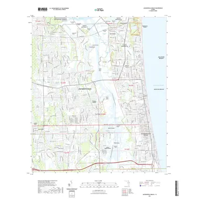
2021 Map of Jacksonville Beach
USGS Topo · Published 2021About this map
The Navsta Mayport Fl military installation dominates the northern reaches of this coastal landscape, where the St. Johns River meets the Atlantic Ocean. This 2021 survey details a complex interface of suburban development and protected wetlands, notably within the Timucuan Ecological and Historic Preserve. The Intracoastal Waterway serves as a central spine, separating the mainland from the barrier island communities of Atlantic Beach, Neptune Beach, and Jacksonville Beach. Local history is preserved in several small burial grounds, including the Mayport Cem and Tillotson Cem, which stand in contrast to modern developments like Isle of Palms and Holiday Harbor. The intricate network of tidal creeks, such as Pablo Creek and Greenfield Creek, illustrates the enduring influence of the marshland on the area's geography and residential patterns.
Find a feature on this map
80 named features on this map. Tap any name to fly to it.
Don’t see what you’re looking for? This feature index may not catch every label — zoom into the map to look around manually.
Map Details
Editions of this 2021 Jacksonville Beach Map
This is the sole edition of this map. No revisions or reprints were ever made.
Other maps of this area

1917 · Orange Park
USGS Topo · 1:62,500

1918 · Jacksonville
USGS Topo · 1:62,500

1918 · Orange Park
USGS Topo · 1:62,500

1918 · Palm Valley
USGS Topo · 1:62,500

1918 · Mayport
USGS Topo · 1:62,500

1948 · Jacksonville
USGS Topo · 1:250,000

1948 · Jacksonville Beach
USGS Topo · 1:24,000

1948 · Eastport
USGS Topo · 1:24,000

1949 · Jacksonville Beach
USGS Topo · 1:24,000

1950 · Arlington
USGS Topo · 1:24,000
Featured Places
- Jacksonville, FL
- Jacksonville Beach, FL
- Atlantic Beach, FL
- Neptune Beach, FL
- Holiday Harbor, Jacksonville