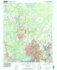
1997 Map of Jacksonville North
USGS Topo · Published 2000About this map
Jacksonville serves as the primary urban center in this late-twentieth-century study, showing significant residential and commercial expansion north toward Half Moon. The landscape is defined by the New River and its tributaries, including Little Mill Creek and Sandy Run, which carved the coastal plain and influenced settlement patterns from Tar Landing to Pumpkin Center. Significant tracts of the White Oak Pocosin and Hofmann Forest dominate the northeastern quadrant, representing the vast timber and wetland environments of Onslow County.
Find a feature on this map
44 named features on this map. Tap any name to fly to it.
Don’t see what you’re looking for? This feature index may not catch every label — zoom into the map to look around manually.
Map Details
Editions of this 1997 Jacksonville North Map
This is the sole edition of this map. No revisions or reprints were ever made.
Other maps of this area

1943 · Jacksonville
USGS Topo · 1:62,500

1948 · Maple Hill
USGS Topo · 1:62,500

1948 · New River
USGS Topo · 1:62,500

1948 · Richlands
USGS Topo · 1:62,500

1952 · Camp Lejeune
USGS Topo · 1:24,000

1952 · Jacksonville South
USGS Topo · 1:24,000

1953 · Beaufort
USGS Topo · 1:250,000

1954 · Beaufort
USGS Topo · 1:250,000

1965 · Richlands
USGS Topo · 1:62,500

1972 · Beaufort
USGS Topo · 1:250,000