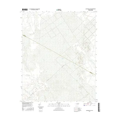
2016 Map of Jacksonville NW
USGS Topo · Published 2016About this map
White Oak Pocosin dominates the central landscape of this coastal plain region, illustrating a sprawling wetland ecosystem characteristic of the Carolina interior. This 2016 survey documents the intricate drainage network of Onslow and Jones Counties, where the headwaters of the N Prong White Oak River and Barnes Br emerge from the dense pocosin. The terrain is defined by slow-moving water features such as Juniper Swamp and Cowhorn Swamp, which intersect with the few established corridors like Quaker Bridge Rd. This map captures the intersection of natural hydrology and forestry management, notably along the boundary of Hoffman Forest Rd, providing a high-resolution view of the local topography before further modern encroachment or environmental shifts altered the water table.
Find a feature on this map
11 named features on this map. Tap any name to fly to it.
Don’t see what you’re looking for? This feature index may not catch every label — zoom into the map to look around manually.
Map Details
Editions of this 2016 Jacksonville NW Map
This is the sole edition of this map. No revisions or reprints were ever made.
Other maps of this area

1903 · Trent River
USGS Topo · 1:62,500

1904 · Trent River
USGS Topo · 1:62,500

1943 · Jacksonville
USGS Topo · 1:62,500

1948 · Richlands
USGS Topo · 1:62,500

1953 · Rocky Mount
USGS Topo · 1:250,000

1953 · Beaufort
USGS Topo · 1:250,000

1954 · Rocky Mount
USGS Topo · 1:250,000

1954 · Beaufort
USGS Topo · 1:250,000

1958 · Deep Run
USGS Topo · 1:62,500

1965 · Richlands
USGS Topo · 1:62,500