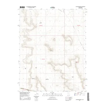
2014 Map of Jacobs Monument
USGS Topo · Published 2014About this map
Jacobs Monument and Tse Dahascani rise from the high plateau of the Navajo Nation in this northern Arizona survey. The landscape is defined by massive sandstone formations including Nokai Mesa and Pickrell Mesa, which dominate the central and western reaches of the quadrangle. This area, straddling the border between Navajo County, Arizona, and San Juan County, Utah, reveals a drainage system carved by the West Fork Copper Canyon and East Fork Copper Canyon. The presence of Copper Canyon Rd and Piute Farms Rd provides the primary access through this remote section of the reservation. The map illustrates the convergence of several mesas near Hoskinnini Mesa, highlighting a terrain shaped by erosion where vertical relief is the primary geographical feature in a region of deep canyons and isolated buttes.
Find a feature on this map
18 named features on this map. Tap any name to fly to it.
Don’t see what you’re looking for? This feature index may not catch every label — zoom into the map to look around manually.
Map Details
Editions of this 2014 Jacobs Monument Map
This is the sole edition of this map. No revisions or reprints were ever made.
Other maps of this area

1883 · Marsh Pass
USGS Topo · 1:250,000

1886 · Henry Mountains
USGS Topo · 1:250,000

1892 · Marsh Pass
USGS Topo · 1:250,000

1892 · Henry Mountains
USGS Topo · 1:250,000

1952 · Clay Hills 3 SE
USGS Topo · 1:24,000

1952 · Shato Spring 1 NE
USGS Topo · 1:24,000

1952 · Agathla Peak 2 NW
USGS Topo · 1:24,000

1952 · Boot Mesa
USGS Topo · 1:62,500

1952 · Clay Hills 3 SW
USGS Topo · 1:24,000

1952 · Agathla Peak 2 NE
USGS Topo · 1:24,000