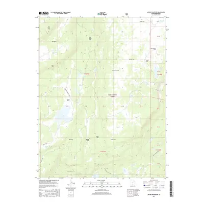
2017 Map of Jacobs Reservoir
USGS Topo · Published 2017About this map
Aquarius Plateau and Boulder Mtn dominate this high-elevation landscape within the Dixie National Forest. This region is defined by a complex network of alpine lakes and catchments, including the prominent Jacobs Reservoir and the more remote Cuddyback Lake and Sawmill Lake to the south. The terrain is marked by dramatic geological features such as Rock Spring Ridge and the Dark Valley Shelf, illustrating the rugged verticality of the Garfield County backcountry. Transport across this wilderness is largely restricted to established paths like the Great Western Trail and specialized routes like the Boulder Swale ATV Trail. Named points such as Burr Top and South Point serve as essential navigational landmarks in a territory where water sources like Squaw Spring were vital for early travelers and livestock.
Find a feature on this map
54 named features on this map. Tap any name to fly to it.
Don’t see what you’re looking for? This feature index may not catch every label — zoom into the map to look around manually.
Map Details
Editions of this 2017 Jacobs Reservoir Map
This is the sole edition of this map. No revisions or reprints were ever made.
Other maps of this area

1885 · Fish Lake
USGS Topo · 1:250,000

1886 · Escalante
USGS Topo · 1:250,000

1896 · Fish Lake
USGS Topo · 1:250,000

1952 · Notom 3 SW
USGS Topo · 1:24,000

1952 · Notom 3 NW
USGS Topo · 1:24,000

1952 · Grover
USGS Topo · 1:62,500

1953 · Loa 4 NE
USGS Topo · 1:24,000

1956 · Escalante
USGS Topo · 1:250,000

1956 · Salina
USGS Topo · 1:250,000

1960 · Escalante
USGS Topo · 1:250,000