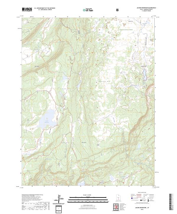
2023 Map of Jacobs Reservoir
USGS Topo · Published 2023About this map
Dixie National Forest covers this high-altitude landscape on Boulder Mtn, where a dense concentration of small glacial lakes and reservoirs defines the hydrology. The central Jacobs Reservoir and the adjacent Jacobs Valley serve as focal points for a network of backcountry routes, including the Jubilee Trl and the Burr Top Trl. The geography is marked by distinct elevation changes, from the Stairs Slope to the expansive Basin Flats, illustrating the varied topography of the Aquarius Plateau.
Find a feature on this map
37 named features on this map. Tap any name to fly to it.
Don’t see what you’re looking for? This feature index may not catch every label — zoom into the map to look around manually.
Map Details
Editions of this 2023 Jacobs Reservoir Map
This is the sole edition of this map. No revisions or reprints were ever made.
Other maps of this area

1885 · Fish Lake
USGS Topo · 1:250,000

1886 · Escalante
USGS Topo · 1:250,000

1896 · Fish Lake
USGS Topo · 1:250,000

1952 · Notom 3 SW
USGS Topo · 1:24,000

1952 · Notom 3 NW
USGS Topo · 1:24,000

1952 · Grover
USGS Topo · 1:62,500

1953 · Loa 4 NE
USGS Topo · 1:24,000

1956 · Escalante
USGS Topo · 1:250,000

1956 · Salina
USGS Topo · 1:250,000

1960 · Escalante
USGS Topo · 1:250,000