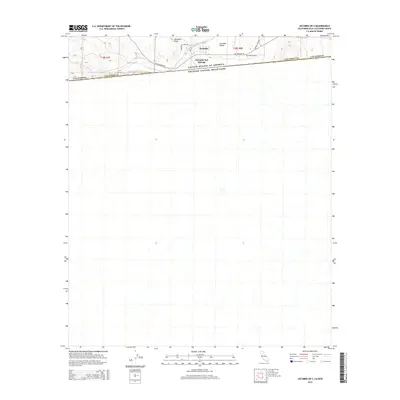
2015 Map of Jacumba OE S
USGS Topo · Published 2015About this map
The high desert community of Jacumba Hot Springs sits at the very edge of the international border in this 2015 survey of southeastern San Diego County. This arid landscape is defined by the proximity of the Estados Unidos Mexicanos boundary, which runs just south of the historic Old Highway 80 corridor. The settlement of Jacumba occupies a strategic point in the Jacumba Valley, flanked by the prominent Jacumba Peak to the west. Evidence of local infrastructure includes the Jacumba Airport and a network of desert routes such as Boundary Creek Rd and Carrizo Creek Rd. The map also traces the path of Boundary Cr as it crosses from California into Mexico, highlighting the complex drainage patterns of this border region where topography and political boundaries intersect.
Find a feature on this map
16 named features on this map. Tap any name to fly to it.
Don’t see what you’re looking for? This feature index may not catch every label — zoom into the map to look around manually.
Map Details
Editions of this 2015 Jacumba OE S Map
This is the sole edition of this map. No revisions or reprints were ever made.
Other maps of this area

1931 · Carrizo
USGS Topo · 1:125,000

1939 · Campo
USGS Topo · 1:62,500

1939 · Jacumba
USGS Topo · 1:62,500

1942 · Campo
USGS Topo · 1:62,500

1942 · Jacumba
USGS Topo · 1:62,500

1950 · San Diego
USGS Topo · 1:250,000

1954 · San Diego
USGS Topo · 1:250,000

1955 · San Diego
USGS Topo · 1:250,000

1958 · San Diego
USGS Topo · 1:250,000
1959 · Jacumba
USGS Topo · 1:24,000