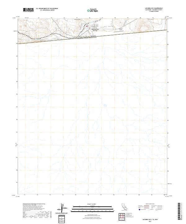
2021 Map of Jacumba OE S
USGS Topo · Published 2021About this map
Jacumba Hot Springs sits at the northern edge of this high-desert landscape, where the international boundary between the United States and Mexico dictates the layout of the land. This 2021 survey illustrates the settlement's infrastructure concentrated just above the border, including local transit routes such as Railroad St, Calexico Ave, and Snob Hill Rd. The terrain is characterized by the broad Jacumba Valley and the prominent Jacumba Peak, which rises west of the town center. The presence of the Jacumba Airport and proximity to Carrizo Creek Rd indicate a region that remains a critical junction for border-region transit and recreation. Water features are sparse but notable, with Boundary Cr winding through the foothills of the southern Sierra Juarez mountains.
Find a feature on this map
12 named features on this map. Tap any name to fly to it.
Don’t see what you’re looking for? This feature index may not catch every label — zoom into the map to look around manually.
Map Details
Editions of this 2021 Jacumba OE S Map
This is the sole edition of this map. No revisions or reprints were ever made.
Other maps of this area

1931 · Carrizo
USGS Topo · 1:125,000

1939 · Campo
USGS Topo · 1:62,500

1939 · Jacumba
USGS Topo · 1:62,500

1942 · Campo
USGS Topo · 1:62,500

1942 · Jacumba
USGS Topo · 1:62,500

1950 · San Diego
USGS Topo · 1:250,000

1954 · San Diego
USGS Topo · 1:250,000

1955 · San Diego
USGS Topo · 1:250,000

1958 · San Diego
USGS Topo · 1:250,000
1959 · Jacumba
USGS Topo · 1:24,000