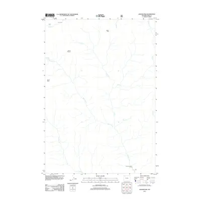
2012 Map of Jaggar Peak
USGS Topo · Published 2012About this map
Jaggar Peak and Mount Pleasant anchor this high-altitude landscape in Park County, where the drainages of the Absaroka range converge. The map documents a rugged hydrographic system characterized by the Sweetwater Cr and its notable Sweetwater Creek Falls, along with the Sweetwater Mineral Springs at the southern edge. Human presence is sparse, marked primarily by the seasonal Winona Camp in the north and the forest roads that navigate the complex terrain. The intricate network of waterways, including Turret Cr, Clearwater Cr, and Sulphur Cr, highlights the importance of these mountain watersheds to the broader regional ecosystem. Distinctive geological formations like Nipple Mesa provide clear landmarks for researchers and land managers studying the backcountry geography of northwestern Wyoming in the early 21st century.
Find a feature on this map
15 named features on this map. Tap any name to fly to it.
Don’t see what you’re looking for? This feature index may not catch every label — zoom into the map to look around manually.
Map Details
Editions of this 2012 Jaggar Peak Map
This is the sole edition of this map. No revisions or reprints were ever made.
Other maps of this area

1893 · Ishawooa
USGS Topo · 1:125,000

1895 · Ishawooa
USGS Topo · 1:125,000

1896 · Crandall Creek
USGS Topo · 1:125,000

1899 · Crandall
USGS Topo · 1:125,000

1899 · Ishawooa
USGS Topo · 1:125,000

1955 · Cody
USGS Topo · 1:250,000

1956 · Sunlight Peak
USGS Topo · 1:62,500

1956 · Dead Indian Peak
USGS Topo · 1:62,500

1958 · Cody
USGS Topo · 1:250,000

1962 · Cody
USGS Topo · 1:250,000