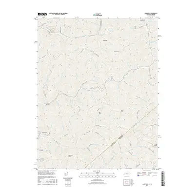
2016 Map of Jamboree
USGS Topo · Published 2016About this map
Jamboree and Coleman sit within a landscape of steep hollows and narrow creek forks along the border of Pike County, Kentucky, and Buchanan County, Virginia. The 2016 terrain is defined by a dense network of watercourses, including Johns Cr and the Blackberry Fork. This geography historically dictated the placement of small communities and infrastructure, with roads like the Big Creek-Motley Branch Rd and Fedscreek Rd winding through the low ground between summits such as Hylton Knob and Phelps Old Mount. For family historians, several family-named landmarks are visible, including the Phillips Cem near Phillips Br and named drainages like Solomon Fork and Cow Br. The map also traces the modern road network, including State Rte 645 and the industrial access of K B C Mine Rd, showing how resource extraction and local transit have shaped this corner of the Appalachian coalfields.
Find a feature on this map
103 named features on this map. Tap any name to fly to it.
Don’t see what you’re looking for? This feature index may not catch every label — zoom into the map to look around manually.
Map Details
Editions of this 2016 Jamboree Map
This is the sole edition of this map. No revisions or reprints were ever made.
Other maps of this area

1886 · Grundy
USGS Topo · 1:125,000

1887 · Warfield
USGS Topo · 1:125,000

1890 · Grundy
USGS Topo · 1:125,000

1891 · Warfield
USGS Topo · 1:125,000

1892 · Grundy
USGS Topo · 1:125,000

1909 · Matewan
USGS Topo · 1:48,000

1914 · Hurley
USGS Topo · 1:48,000

1915 · Regina
USGS Topo · 1:48,000

1915 · Hurley
USGS Topo · 1:48,000

1915 · Williamson
USGS Topo · 1:48,000