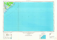
1968 Map of James Island
USGS Topo · Published 1968About this map
Charleston and its harbor defenses anchor this mid-century topographic survey of the South Carolina coast. The map highlights a landscape defined by the convergence of the Ashley River, Cooper River, and Wando River, where urban centers like North Charleston were expanding alongside vital military installations. Historical coastal fortifications including Fort Sumter and Fort Moultrie remain prominent landmarks, overseeing the entrance to the harbor near Sullivans Island and Morris Island.
Find a feature on this map
40 named features on this map. Tap any name to fly to it.
Don’t see what you’re looking for? This feature index may not catch every label — zoom into the map to look around manually.
Map Details
Editions of this 1968 James Island Map
This is the sole edition of this map. No revisions or reprints were ever made.
Other maps of this area

1918 · Kiawah Island
USGS Topo · 1:21,120

1919 · Ladson
USGS Topo · 1:21,120

1919 · Johns Island
USGS Topo · 1:21,120

1919 · Summerville
USGS Topo · 1:48,000

1919 · The Jetties
USGS Topo · 1:21,120

1919 · Capers Island
USGS Topo · 1:21,120

1919 · Wadmelaw Island
USGS Topo · 1:62,500

1919 · Wando
USGS Topo · 1:21,120

1919 · Cordesville
USGS Topo · 1:48,000

1919 · Melgrove
USGS Topo · 1:21,120