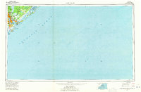
1969 Map of James Island
USGS Topo · Published 1971About this map
Charleston and its surrounding barrier islands are captured here during a period of significant coastal development and military presence. This 1:250,000-scale overview emphasizes the complex maritime geography of the South Carolina coast, from the US Naval Reservation along the Cooper River to the established neighborhoods of Mount Pleasant and St Andrews. The map details the transition from urban centers like Charleston Heights to the protected wetlands of the Cape Romain National Wildlife Refuge. Notable landmarks such as Fort Sumter National Monument and Ft Moultrie underscore the area's deep naval history. For those tracing local development, the map shows the footprint of communities like Scanlonville and The Groves before the intensification of modern suburban expansion, while marking the critical transport links provided by the SCL railroad and the Cooper River and Wando River systems.
Find a feature on this map
73 named features on this map. Tap any name to fly to it.
Don’t see what you’re looking for? This feature index may not catch every label — zoom into the map to look around manually.
Map Details
Editions of this 1969 James Island Map
2 editions found
Other maps of this area

1918 · Kiawah Island
USGS Topo · 1:21,120

1919 · Ladson
USGS Topo · 1:21,120

1919 · Johns Island
USGS Topo · 1:21,120

1919 · Summerville
USGS Topo · 1:48,000

1919 · The Jetties
USGS Topo · 1:21,120

1919 · Capers Island
USGS Topo · 1:21,120

1919 · Wadmelaw Island
USGS Topo · 1:62,500

1919 · Wando
USGS Topo · 1:21,120

1919 · Cordesville
USGS Topo · 1:48,000

1919 · Melgrove
USGS Topo · 1:21,120