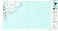
1986 Map of James Island
USGS Topo · Published 1986About this map
The confluence of the Ashley River, Cooper River, and Wando River defines this coastal landscape, where the urban density of Charleston meets the expansive salt marshes and barrier islands of the Lowcountry. In the mid-1980s, the region's military and maritime significance is evident through the US Naval Reservation and the presence of Fort Sumter Natl Mon guarding the entrance to Charleston Harbor. Commercial and industrial patterns are traced via the Southern RR and the Intracoastal Waterway, which snakes behind the coastline.
Find a feature on this map
112 named features on this map. Tap any name to fly to it.
Don’t see what you’re looking for? This feature index may not catch every label — zoom into the map to look around manually.
Map Details
Editions of this 1986 James Island Map
This is the sole edition of this map. No revisions or reprints were ever made.
Other maps of this area

1918 · Kiawah Island
USGS Topo · 1:21,120

1919 · Ladson
USGS Topo · 1:21,120

1919 · Johns Island
USGS Topo · 1:21,120

1919 · Summerville
USGS Topo · 1:48,000

1919 · The Jetties
USGS Topo · 1:21,120

1919 · Capers Island
USGS Topo · 1:21,120

1919 · Wadmelaw Island
USGS Topo · 1:62,500

1919 · Wando
USGS Topo · 1:21,120

1919 · Cordesville
USGS Topo · 1:48,000

1919 · Melgrove
USGS Topo · 1:21,120