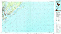
1990 Map of James Island
USGS Topo · Published 1990About this map
The confluence of the Ashley River, Cooper River, and Wando River defines this Lowcountry landscape, anchoring the historic port at Charleston. By the late 20th century, the urban footprint had expanded significantly into North Charleston and across the harbor to Mount Pleasant, yet vast reaches of protected coastal wilderness remain. To the northeast, the Francis Marion National Forest and the Cape Romain National Wildlife Refuge preserve a complex network of salt marshes, sounds, and barrier islands, including Bull Island and Capers Island. This coastal geography is further defined by its military and maritime heritage, with the U.S. Naval Reservation situated north of the city and Fort Sumter Natl Mon standing guard at the entrance to Charleston Harbor. Local history is visible in smaller settlements and neighborhoods like Scanlonville, Sol Legare Island, and Riverland Terrace, while the Intracoastal Waterway provides a vital link through the marshes and bays behind the barrier beaches.
Find a feature on this map
285 named features on this map. Tap any name to fly to it.
Don’t see what you’re looking for? This feature index may not catch every label — zoom into the map to look around manually.
Map Details
Editions of this 1990 James Island Map
This is the sole edition of this map. No revisions or reprints were ever made.
Other maps of this area

1918 · Kiawah Island
USGS Topo · 1:21,120

1919 · Ladson
USGS Topo · 1:21,120

1919 · Johns Island
USGS Topo · 1:21,120

1919 · Summerville
USGS Topo · 1:48,000

1919 · The Jetties
USGS Topo · 1:21,120

1919 · Capers Island
USGS Topo · 1:21,120

1919 · Wadmelaw Island
USGS Topo · 1:62,500

1919 · Wando
USGS Topo · 1:21,120

1919 · Cordesville
USGS Topo · 1:48,000

1919 · Melgrove
USGS Topo · 1:21,120