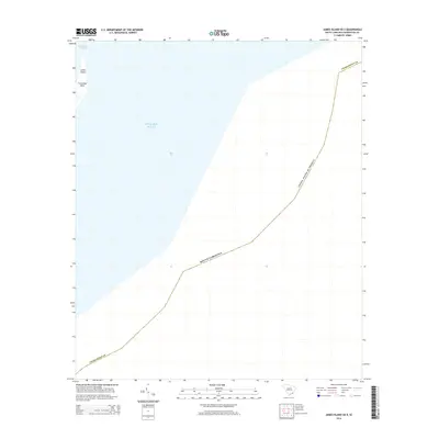
2014 Map of James Island OE E
USGS Topo · Published 2014About this map
Cummings Point stands at the edge of the land on this coastal survey, marking a significant transition between the interior marshes and the open sea. Located on the eastern tip of James Island, this point overlooks the entry to Charleston Harbor, a critical maritime gateway for the South Carolina coast. The map illustrates the expansive offshore waters of the Atlantic Ocean and the maritime boundary of the United States of America. Primarily focused on the hydrography and shoreline of Charleston County, the sheet provides a clear look at the coastal geography of the Lowcountry just after the first decade of the millennium.
Find a feature on this map
7 named features on this map. Tap any name to fly to it.
Don’t see what you’re looking for? This feature index may not catch every label — zoom into the map to look around manually.
Map Details
Editions of this 2014 James Island OE E Map
This is the sole edition of this map. No revisions or reprints were ever made.
Other maps of this area

1919 · The Jetties
USGS Topo · 1:21,120

1919 · Capers Island
USGS Topo · 1:21,120

1919 · Charleston
USGS Topo · 1:21,120

1919 · James Island
USGS Topo · 1:21,120

1919 · Fort Moultrie
USGS Topo · 1:21,120

1943 · Capers Island
USGS Topo · 1:24,000

1943 · Fort Moultrie
USGS Topo · 1:24,000

1943 · James Island
USGS Topo · 1:24,000

1948 · James Island
USGS Topo · 1:250,000
1948 · Charleston
USGS Topo · 1:24,000