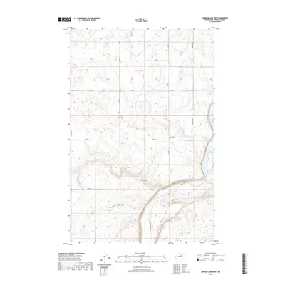
2020 Map of Jameson Lake West
USGS Topo · Published 2020About this map
Jameson Lake defines the eastern boundary of this Douglas County landscape, where the high plateau of the Columbia Basin meets the steep coulee walls. This 2020 edition reveals a geography dominated by a structured grid of rural roads, including Mansfield S Rd and N Division Rd, which provide access to the dryland agricultural tracts of T26N R25E and T25N R25E. The presence of Jameson Cem near Berg Rd marks a quiet pocket of local heritage amidst the wide-open terrain.
Find a feature on this map
22 named features on this map. Tap any name to fly to it.
Don’t see what you’re looking for? This feature index may not catch every label — zoom into the map to look around manually.
Map Details
Editions of this 2020 Jameson Lake West Map
This is the sole edition of this map. No revisions or reprints were ever made.
Other maps of this area

1953 · Ritzville
USGS Topo · 1:250,000

1959 · Ritzville
USGS Topo · 1:250,000

1965 · Ritzville
USGS Topo · 1:250,000

1965 · Jameson Lake SW
USGS Topo · 1:24,000

1965 · Jameson Lake SE
USGS Topo · 1:24,000

1965 · Jameson Lake West
USGS Topo · 1:24,000

1965 · Jameson Lake East
USGS Topo · 1:24,000

1968 · Withrow
USGS Topo · 1:24,000
1968 · Mud Spring
USGS Topo · 1:24,000
1968 · Farmer
USGS Topo · 1:24,000