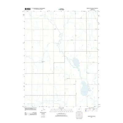
2012 Map of Jamestown NW
USGS Topo · Published 2012About this map
Caldwell Cem and Mc Collough Airfield stand as human marks within a landscape defined by an intricate drainage system in Cloud County. This 2012 survey reveals the winding paths of Marsh Cr and its tributaries, including W Marsh Cr and E Marsh Cr, as they traverse the agricultural plains. In the southern portion of the quadrangle, Buffalo Cr and Dry Cr establish the natural hydrology of the region. The presence of Sportsmans Lake near the confluence of Skunk Cr and Saint Johns Cr highlights local water management and recreation areas. The map's grid of county roads, such as Omio Rd and N 10th Rd, underscores the persistent section-line development typical of North Central Kansas, providing a detailed record of land use and property access early in the twenty-first century.
Find a feature on this map
25 named features on this map. Tap any name to fly to it.
Don’t see what you’re looking for? This feature index may not catch every label — zoom into the map to look around manually.
Map Details
Editions of this 2012 Jamestown NW Map
This is the sole edition of this map. No revisions or reprints were ever made.
Other maps of this area

1892 · Concordia
USGS Topo · 1:125,000

1894 · Mankato
USGS Topo · 1:125,000

1955 · Manhattan
USGS Topo · 1:250,000

1955 · Beloit
USGS Topo · 1:250,000

1956 · Manhattan
USGS Topo · 1:250,000

1957 · Manhattan
USGS Topo · 1:250,000

1959 · Beloit
USGS Topo · 1:250,000

1962 · Jewell SE
USGS Topo · 1:24,000

1965 · Kackley
USGS Topo · 1:24,000

1966 · Scandia
USGS Topo · 1:24,000