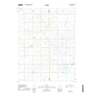
2018 Map of Jamestown NW
USGS Topo · Published 2018About this map
The intersection of Republic, Jewell, and Cloud Counties in north-central Kansas defines this rural landscape, dominated by a complex network of waterways feeding into the Republican River basin. Central to this area is the expansive Marsh Creek wetland system, which includes the recreational waters of Sportsmans Lake and is traversed by the dedicated Marsh Trl. The map illustrates a strictly partitioned agrarian grid, where section lines are marked by local routes like Omio Rd and Valley Rd.
Find a feature on this map
42 named features on this map. Tap any name to fly to it.
Don’t see what you’re looking for? This feature index may not catch every label — zoom into the map to look around manually.
Map Details
Editions of this 2018 Jamestown NW Map
This is the sole edition of this map. No revisions or reprints were ever made.
Other maps of this area

1892 · Concordia
USGS Topo · 1:125,000

1894 · Mankato
USGS Topo · 1:125,000

1955 · Manhattan
USGS Topo · 1:250,000

1955 · Beloit
USGS Topo · 1:250,000

1956 · Manhattan
USGS Topo · 1:250,000

1957 · Manhattan
USGS Topo · 1:250,000

1959 · Beloit
USGS Topo · 1:250,000

1962 · Jewell SE
USGS Topo · 1:24,000

1965 · Kackley
USGS Topo · 1:24,000

1966 · Scandia
USGS Topo · 1:24,000