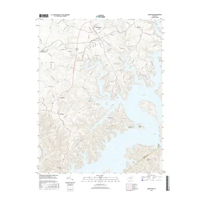
2016 Map of Jamestown
USGS Topo · Published 2016About this map
Jamestown serves as the focal point of this Russell County landscape, where the street grid of N Main St and W Cumberland Ave meets the meandering shoreline of Lake Cumberland. The topography is defined by the deep indentations of the reservoir, carving out complex peninsulas and naming landforms such as Wright Hollow and Pig Pen Point. To the south and west, the map records rural crossroads and established settlements like Sewellton, Freedom, and Rowena, which sits near the banks of the Cumberland River. The distribution of burial sites, including Murray Cem, Lawless Cem, and Keen Cem, provides significant data for genealogical research, anchoring family histories to specific ridges and hollows. The transition from the developed center of Jamestown to the isolated stretches of Lowgap Island and School House Hollow illustrates the dramatic impact of the impounded river on local geography and transport.
Find a feature on this map
113 named features on this map. Tap any name to fly to it.
Don’t see what you’re looking for? This feature index may not catch every label — zoom into the map to look around manually.
Map Details
Editions of this 2016 Jamestown Map
This is the sole edition of this map. No revisions or reprints were ever made.
Other maps of this area

1911 · Monticello
USGS Topo · 1:62,500

1914 · Monticello
USGS Topo · 1:62,500

1953 · Montpelier
USGS Topo · 1:24,000

1953 · Parnell
USGS Topo · 1:24,000

1953 · Wolf Creek Dam
USGS Topo · 1:24,000

1953 · Creelsboro
USGS Topo · 1:24,000

1953 · Jamestown
USGS Topo · 1:24,000

1954 · Jabez
USGS Topo · 1:24,000

1954 · Cumberland City
USGS Topo · 1:24,000

1954 · Russell Springs
USGS Topo · 1:24,000