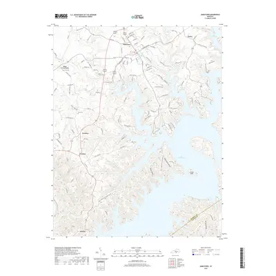
2019 Map of Jamestown
USGS Topo · Published 2019About this map
Lake Cumberland dominates the eastern half of this landscape, its dendritic fingers reaching deep into the hills of Russell County. The intricate shoreline surrounds Lowgap Island and follows the winding paths of several tributaries including Lily Cr and Pumpkin Cr. This modern survey illustrates the proximity between the high ground of Jamestown and the expansive reservoir, reflecting the region's adaptation to the impounded Cumberland River.
Find a feature on this map
120 named features on this map. Tap any name to fly to it.
Don’t see what you’re looking for? This feature index may not catch every label — zoom into the map to look around manually.
Map Details
Editions of this 2019 Jamestown Map
This is the sole edition of this map. No revisions or reprints were ever made.
Other maps of this area

1911 · Monticello
USGS Topo · 1:62,500

1914 · Monticello
USGS Topo · 1:62,500

1953 · Montpelier
USGS Topo · 1:24,000

1953 · Parnell
USGS Topo · 1:24,000

1953 · Wolf Creek Dam
USGS Topo · 1:24,000

1953 · Creelsboro
USGS Topo · 1:24,000

1953 · Jamestown
USGS Topo · 1:24,000

1954 · Jabez
USGS Topo · 1:24,000

1954 · Cumberland City
USGS Topo · 1:24,000

1954 · Russell Springs
USGS Topo · 1:24,000