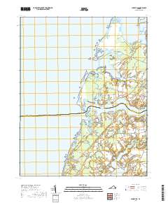
2019 Map of Jamesville
USGS Topo · Published 2019About this map
Occohannock Creek and Nandua Creek define the jagged fingers of Virginia's Eastern Shore documented in this late-2010s survey. The landscape is characterized by its tidal geography, where numerous necks—including Scarborough Neck, Craddock Neck, and Occohannock Neck—extend into the Chesapeake Bay. Small communities such as Jamesville, Davis Wharf, and Wardtown are connected by a network of rural roads like Occohannock Neck Rd and Craddock Neck Rd, illustrating a settlement pattern that remains closely tied to the water. The boundary between Accomack Co and Northampton Co cuts through the middle of this maritime region. Ge genealogists and local historians can trace legacy landforms such as Powells Bluff, Gaskins Point, and Sandy Point, alongside interior features like Adkins Pond and Costin Pond that sit just inland from the marshes.
Find a feature on this map
79 named features on this map. Tap any name to fly to it.
Don’t see what you’re looking for? This feature index may not catch every label — zoom into the map to look around manually.
Map Details
Editions of this 2019 Jamesville Map
This is the sole edition of this map. No revisions or reprints were ever made.
Other maps of this area

1942 · Nandua Creek
USGS Topo · 1:24,000

1942 · Nassawadox
USGS Topo · 1:24,000

1943 · Nassawadox
USGS Topo · 1:31,680

1943 · Jamesville
USGS Topo · 1:31,680

1943 · Pungoteague
USGS Topo · 1:31,680

1943 · Franktown
USGS Topo · 1:31,680

1943 · Exmore
USGS Topo · 1:24,000

1943 · Richmond
USGS Topo · 1:250,000

1944 · Exmore
USGS Topo · 1:31,680

1946 · Eastville
USGS Topo · 1:250,000