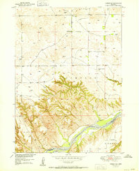
1951 Map of Jamison SW
USGS Topo · Published 1951About this map
The Niobrara River flows through the southern portion of this landscape, marking a significant topographical transition between the elevated plains of Mills and Simpson and the river valley below. In the early 1950s, this rural area of Keya Paha and Rock counties was defined by a sparse network of section-line roads and remote prairie infrastructure. Educational life for local farm families centered on country schools such as Bothwell Sch in the north and Holton Sch near the Kirkwood area. Numerous windmills are documented across the plains, indicating the critical role of groundwater for livestock in this environment. The map details several small waterways contributing to the basin, including Big Anne Creek and Rock Creek, along with smaller settlements like Dyer situated near the riverbanks.
Find a feature on this map
15 named features on this map. Tap any name to fly to it.
Don’t see what you’re looking for? This feature index may not catch every label — zoom into the map to look around manually.
Map Details
Editions of this 1951 Jamison SW Map
2 editions found
Other maps of this area

1949 · Jamison SW
USGS Topo · 1:24,000

1949 · Riverview
USGS Topo · 1:24,000

1949 · Carns
USGS Topo · 1:24,000

1950 · Carns
USGS Topo · 1:24,000

1950 · Riverview
USGS Topo · 1:24,000

1950 · Mariaville
USGS Topo · 1:24,000

1951 · Jamison SW
USGS Topo · 1:24,000

1954 · Newport NE
USGS Topo · 1:24,000

1955 · O'Neill
USGS Topo · 1:250,000

1959 · O'Neill
USGS Topo · 1:250,000