
1951 Map of Jamison SW
USGS Topo · Published 1951About this map
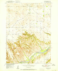
The Niobrara River carves a deep valley across the southern portion of this landscape, marking the boundary between Keya Paha and Rock counties. In the post-war era of the late 1940s, this region of the Nebraska Sandhills remained sparsely populated, defined by isolated schoolhouses and cattle ranching across the Simpson and Kirkwood townships. The map documents the rural infrastructure of the period, including Bothwell Sch in the north and Holton Sch further south near Willow Creek. Water sources were critical to the local economy, evidenced by named features like Big Anne Spring and the small settlement of Dyer situated just north of the river. The terrain transitions from the high, relatively flat prairie of the north to the heavily dissected breaks leading down to the river valley, illustrating the geomorphology that dictated settlement patterns in this part of north-central Nebraska.
Find a feature on this map
13 named features on this map. Tap any name to fly to it.
Don’t see what you’re looking for? This feature index may not catch every label — zoom into the map to look around manually.
Map Details
Editions of this 1951 Jamison SW Map
2 editions found
Other maps of this area

1949 · Jamison SW
USGS Topo · 1:24,000

1949 · Riverview
USGS Topo · 1:24,000

1949 · Carns
USGS Topo · 1:24,000

1950 · Carns
USGS Topo · 1:24,000

1950 · Riverview
USGS Topo · 1:24,000

1950 · Mariaville
USGS Topo · 1:24,000

1954 · Newport NE
USGS Topo · 1:24,000

1955 · O'Neill
USGS Topo · 1:250,000

1959 · O'Neill
USGS Topo · 1:250,000

1964 · Mills
USGS Topo · 1:24,000