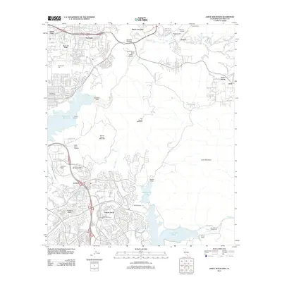
2012 Map of Jamul Mountains
USGS Topo · Published 2012About this map
Rancho San Diego and the surrounding highlands of the Jamul Mountains appear here during a period of significant suburban expansion in the early 2010s. The landscape is defined by the contrast between dense residential developments like Eastlake Greens and the steep, preserved terrain of San Miguel Mountain and Mother Miguel Mountain. Water management is central to the area's geography, with the Sweetwater River flowing toward the Sweetwater Reservoir and the massive Second San Diego Aqueduct cutting through the valley floor. To the south, the map details the recreation and infrastructure around Lower Otay Lake and the smaller Upper Otay Lake. Smaller settlements and historical landholdings such as Fenton Ranch and Rancho del Otay sit alongside modern aviation at John Nichol's Field Airport.
Find a feature on this map
42 named features on this map. Tap any name to fly to it.
Don’t see what you’re looking for? This feature index may not catch every label — zoom into the map to look around manually.
Map Details
Editions of this 2012 Jamul Mountains Map
This is the sole edition of this map. No revisions or reprints were ever made.
Other maps of this area

1893 · El Cajon
USGS Topo · 1:62,500

1901 · Elcajon
USGS Topo · 1:62,500

1903 · Cuyamaca
USGS Topo · 1:125,000

1903 · La Jolla
USGS Topo · 1:62,500

1903 · Elcajon
USGS Topo · 1:62,500

1904 · San Diego
USGS Topo · 1:62,500

1904 · Southern California Sheet No. 2
USGS Topo · 1:250,000

1930 · La Jolla
USGS Topo · 1:62,500

1930 · San Diego
USGS Topo · 1:62,500

1939 · El Cajon
USGS Topo · 1:62,500