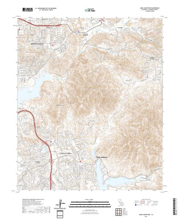
2021 Map of Jamul Mountains
USGS Topo · Published 2021About this map
Spring Valley and Chula Vista flank a complex landscape of canyon terrain and critical water infrastructure in this modern topographical study. The Sweetwater River is a primary drainage, feeding the expansive Sweetwater Reservoir near Neal Cove, while further south, Upper Otay Lake and Lower Otay Lake are prominent landmarks. These reservoirs highlight the region's managed water resources, essential for the residential developments seen at Homelands, Cockatoo Grove, and the Jamul Valley. Educational institutions like Cuyamaca College and Southwestern College are situated within these growing communities. The topography is dominated by the steep slopes of San Miguel Mtn and Mother Miguel Mtn, which separate the suburban outskirts of San Diego from the interior valleys and ridges. Local transit and aviation are represented by the network of Otay Lakes Road and the presence of John Nichols Field.
Find a feature on this map
71 named features on this map. Tap any name to fly to it.
Don’t see what you’re looking for? This feature index may not catch every label — zoom into the map to look around manually.
Map Details
Editions of this 2021 Jamul Mountains Map
This is the sole edition of this map. No revisions or reprints were ever made.
Other maps of this area

1893 · El Cajon
USGS Topo · 1:62,500

1901 · Elcajon
USGS Topo · 1:62,500

1903 · Cuyamaca
USGS Topo · 1:125,000

1903 · La Jolla
USGS Topo · 1:62,500

1903 · Elcajon
USGS Topo · 1:62,500

1904 · San Diego
USGS Topo · 1:62,500

1904 · Southern California Sheet No. 2
USGS Topo · 1:250,000

1930 · La Jolla
USGS Topo · 1:62,500

1930 · San Diego
USGS Topo · 1:62,500

1939 · El Cajon
USGS Topo · 1:62,500